docs.unavlab.com
Main ❯ Navigation & tracking systems ❯ Zima2 LBL: Data brief
ℹ Recommendations for printing / saving as PDF
- Press Ctrl+P (macOS: Cmd+P)
- Select "Save as PDF" (Microsoft Print to PDF) as the printer
- In "Pages", enter a range that excludes the first and the last page
- Disable headers and footers (title, URL, page numbers)
- In Chrome/Edge: More settings → "Margins" → None | in Firefox: "Margins & Header/Footer" → None
- Click Print and choose where to save the PDF
 |
|
|---|---|
| www.unavlab.com support@unavlab.com |
Zima 2 LBL Data brief |
General information
Zima 2 LBL is an underwater acoustic long baseline (LBL) navigation system designed to determine the location of an underwater object using a navigation base formed by Zima2-R responder-beacons.
The system is built on a single hardware platform: the Zima2-L and Zima2-LX transceivers can be reprogrammed into each other. This makes it possible to change the system configuration to suit the task without replacing the equipment.
System composition
| Zima2-L LBL transceiver with a common request to the navigation base (3–4 responder-beacons with addresses 1-4) |
|
| Zima2-LX LBL transceiver with sequential interrogation of up to 4 responder-beacons with arbitrary addresses |
|
| Zima2-SL Solver: position calculation and GNSS emulation |
|
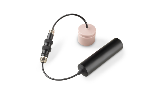 |
Zima2-R Reference responder-beacons |
System configuration options
The Zima 2 LBL system can be assembled in one of three modes, depending on the required update rate, the number of responder-beacons and where the result is to be calculated.
Mode 1. Zima2-L – maximum update rate
The Zima2-L transceiver sends a common (broadcast) request to a fixed navigation base of 3 or 4 responder-beacons with fixed addresses 1-4. The responder-beacons reply after fixed delays that depend on their address. The position is calculated by an external application on the user’s side.
- Advantages: maximum position update rate, minimum latency. Possibility of placing the responder-beacons on a moving platform (the bottom of a vessel) with the coordinate system tied to the platform.
- Limitations: fixed responder-beacon addresses, the position is calculated by external software, all reference responder-beacons must be within a circle of 265 meters radius.
Mode 2. Zima2-LX – arbitrary set of responder-beacons
The Zima2-LX transceiver sequentially interrogates 3 or 4 responder-beacons with arbitrary addresses and measures the range to each of them. The results are transmitted over UART to an external computing unit – the Zima2-SL module.
- Advantages: flexibility – responder-beacons with arbitrary addresses.
- Limitations: the update rate is lower than that of Zima2-L, because the interrogation is sequential.
Mode 3. Zima2-LX + Zima2-SL – standalone position calculation
The Zima2-LX + Zima2-SL combination provides a ready-made solution: LX measures the ranges, SL stores the coordinates of the responder-beacons, calculates the position and outputs it to the user in the form of standard GNSS sentences (GGA, RMC, MTW). This makes it possible to connect the system wherever a regular GNSS receiver is expected.
- Advantages: no external software is needed, the output is a familiar GNSS stream.
- Limitations: the update rate is determined by the rate of the sequential interrogation by LX.
Comparison of modes
| Characteristic | Zima2-L | Zima2-LX | Zima2-LX + Zima2-SL |
|---|---|---|---|
| Number of responder-beacons | 3–4 | 3–4 | 3–4 |
| Interrogation scheme | common request | sequential | sequential |
| Position calculation | external software | external software | Zima2-SL |
| Output | ranges | ranges | GGA, RMC, MTW |
| Relative update rate | maximum | medium | medium |
Tasks to be solved
- Determining the location of an object in a local coordinate system (x, y, z) if the positions of the reference responder-beacons are specified in a local Cartesian coordinate system
- Determining the absolute location (latitude, longitude, depth) if the positions of the reference responder-beacons are specified in a geographic coordinate system
Distinctive features
- Compactness, long range and maximum ease of use make it possible to use the Zima2 system to work with various ROVs and AUVs as well as with divers
- The high versatility of the responder-beacons makes it possible to use them either in a standalone version with a separate battery pack or integrated with the carrier for both power and data
- A single hardware platform for the transceivers and the solver: the role of a device is changed by changing the firmware
- A unique feature of the system is the possibility of placing the reference points on a moving base, for example, on the bottom of a vessel, so that the positioned object is tied to a coordinate system associated with the moving vessel
Geometric limitations
Zima2-L mode (common request)
- the reference points must be located within a circle of 265 m radius, but no closer than 40 m to each other;
- the limitation is due to the TDMA interrogation scheme: the responder-beacons reply according to their address with a fixed delay;
- continuous line of sight through the water column between the transceiver and all reference points is required for the system to operate.
Zima2-LX mode (sequential interrogation)
- there are no restrictions on the geometry of the base - responder-beacons with arbitrary addresses can be used;
- the positions of the reference responder-beacons are determined in advance, for example, by the VLBL method;
- the only limitation is the acoustic communication range determined by the link budget, up to 3000 m[1];
- continuous line of sight through the water column between the transceiver and all reference points is required for the system to operate.